
Landplot with 3 ha size, partially flat, in Minas Gerais near São Roque
Details
Landplot Minas Gerais: Land with 3 ha size, flat, 2 mineral water sources, currently being georeferenced, stunningly beautiful location
General Information and Features:
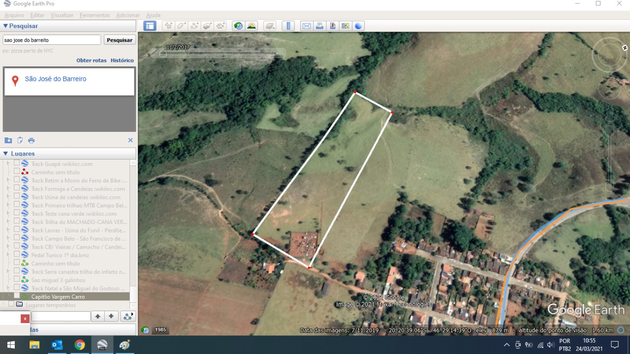
This landplot is located in São José do Barreiro, a district of São Roque in the Brazilian state of Minas Gerais at the end of the Rua Antenor Alves Vilela, 302, bordering the Pousada “Paredão da Canastra”.
It is approximately 8 km distant from the Casca d’Anta Waterfall as well as several other waterfalls within the Serra da Canastra National Park.
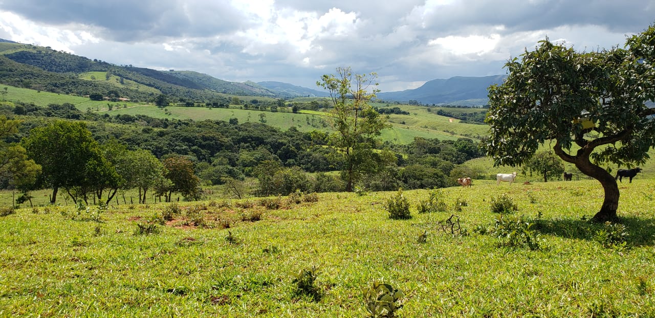
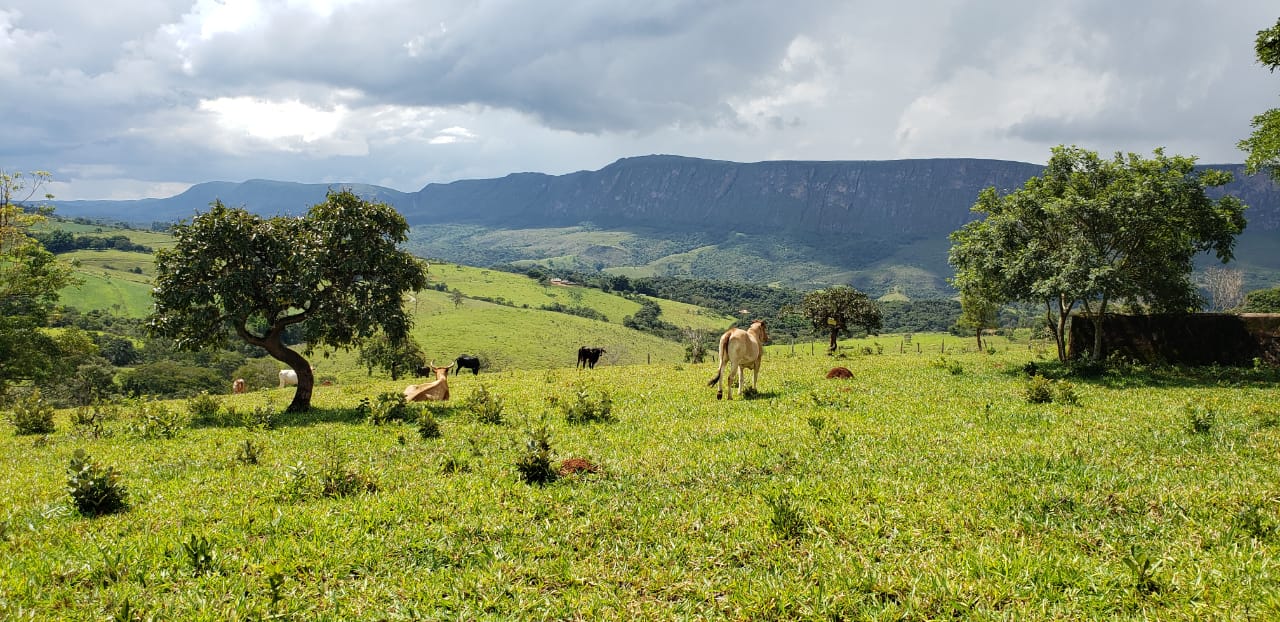
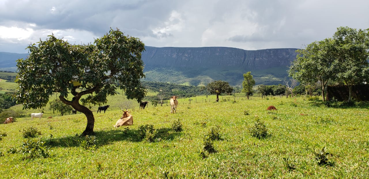
The land has a flat topography, with a low front facing a beautiful landscape and is located next to the Serra da Babilonia. Furthermore, there are two springs of crystalline water which provide the potential to plant a variety of native trees.
The documentation is up to date – it is currently part of a larger property and needs to be dismembered (“desmembramento”). Details can be sent on request.
Currently there is cattle on the land and it is suitable to use as a small farm with pasture. Due to its location there is also ample touristic potential, including the construction of a hotel. Georeferencing is currently taking place.
Additional videos beside the one attached to this exposé can be sent on request.
We accompany clients during the entire sales process and provide encompassing consulting services.
Additional Information about the Serra da Canastra Region and Surroundings:
The Serra da Canastra National Park is one of the most important Brazilian national parks. Within the park there is located the historical source of the São Francisco River, in the municipality of São Roque de Minas.
The most important region of Serra da Canastra is the area already regulated by the National Park, which has 4 accesses: one near São Roque de Minas (8 km from the city), in the districts of São José do Barreiro (9 km), São João Batista (1 km) and Sacramento (65 km from the city). The accesses via Sacramento and São João Batista are usually by long dirt roads, which can be precarious during the rainy season. For São José do Barreiro, the stretch of land is considerably shorter (22 km) and for São Roque de Minas it is only 8 km. Through São José do Barreiro, the visitor has direct access to the bottom of the Casca D’Anta Waterfall, one of the most striking attractions of the Serra da Canastra.
The region has a high touristic, but also agricultural potential, with the main rural activities comprising coffee cultivation, followed by soy and corn plantation.
Further Regional Information:
- https://www.serradacanastra.com.br/cidades/sao-roque-de-minas
- https://www.serradacanastra.com.br/como-chegar/carro
- https://www.guiaviagensbrasil.com/blog/guia-completo-da-serra-da-canastra/
Landplot Minas Gerais
- Property type: Farm or Ranch (Fazenda) , Landplot
- State: Minas Gerais
- Offer type: For Sale
- City: São Roque
- Postal Code and Neighbourhood: 37928-000 São José do Barreiro
- Lot size: 3 ha
- Property ID: 19101


Video
- ID: 19101
- Views: 3413